


How to Explore a Neighborhood Without Visiting Israel: Drones, Maps, Panoramas (654)
Introduction
When planning a move to Israel, many immigrants face the challenge of evaluating a neighborhood without being physically present. Today, technology allows for a detailed remote study of areas. Using drones, online maps, and panorama services, you can gain an accurate understanding of infrastructure, residential complexes, green zones, and transportation accessibility.
Modern Tools for Exploring a Neighborhood
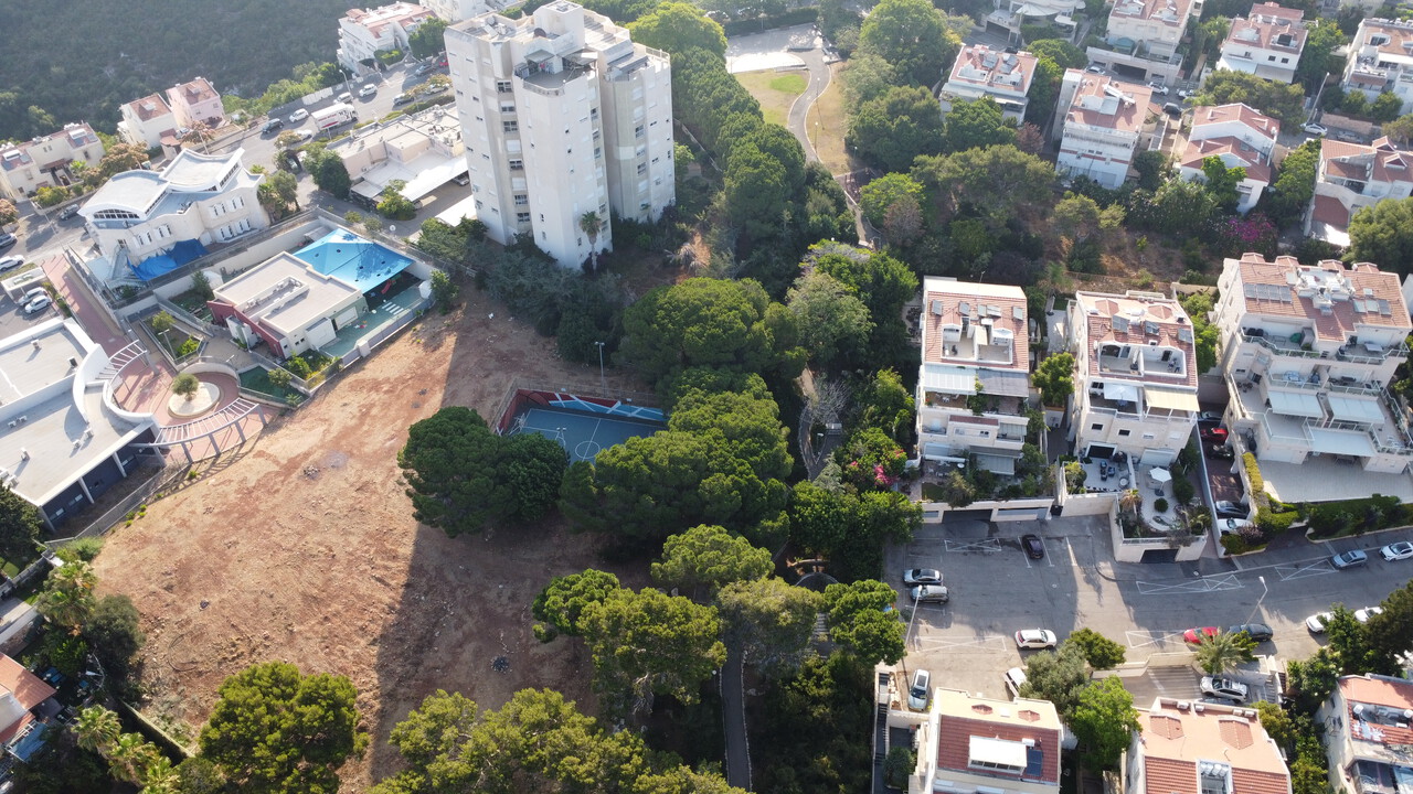
Drones and Aerial Photography
- Provide a bird’s-eye view of the city, showing building density, parks, and green spaces.
- Allow you to examine nearby streets, parking availability, shops, and schools.
Online Maps and Satellite Images
- Services like Google Maps and Bing Maps provide precise information about terrain, streets, and infrastructure.
- Measure distances to work, schools, and stores.
Panorama Services (Street View)
- Let you “walk” through streets virtually and assess safety, building quality, and neighborhood atmosphere.
- Useful for evaluating infrastructure: transport connections, shops, schools, and hospitals.
How to Use Technology Effectively
- Make a list of neighborhoods of interest and explore each using multiple platforms.
- Compare neighborhoods by infrastructure, green spaces, and transport accessibility.
- Observe building density and surrounding areas — it affects living comfort.
- Use drone videos and panoramas to assess the neighborhood’s potential for rent or purchase.
- If needed, consult local specialists for additional verification of the area.
Unehasim Tips
- Start exploring neighborhoods early, even before arriving in Israel, to understand expectations.
- Use multiple information sources: maps, satellite images, drone footage, and panoramas.
- Compare neighborhoods by housing cost, infrastructure, and safety.
- Contact Unehasim specialists for detailed information on neighborhoods, including hidden details and current real estate offers.
Conclusion
Even without visiting Israel, you can form a comprehensive picture of a neighborhood using modern technology: drones, online maps, and panorama services. This helps immigrants plan their move in advance, select the right neighborhood, and assess living quality.
For detailed guidance and virtual neighborhood tours, contact Unehasim specialists — they will help you find the optimal neighborhood and housing according to your needs.